Modern Situational Awareness of Oceanographic Vehicles
OceanLens is a modular, flexible and responsive platform for user-centered, interactive geospatial data visualization. We are solving an exciting and complex problem for the future where ocean robotics transforms operations at sea. This future is already here.
Our Partners
Features
Improve the situational awareness of your fleet like never before and reduce operational overhead
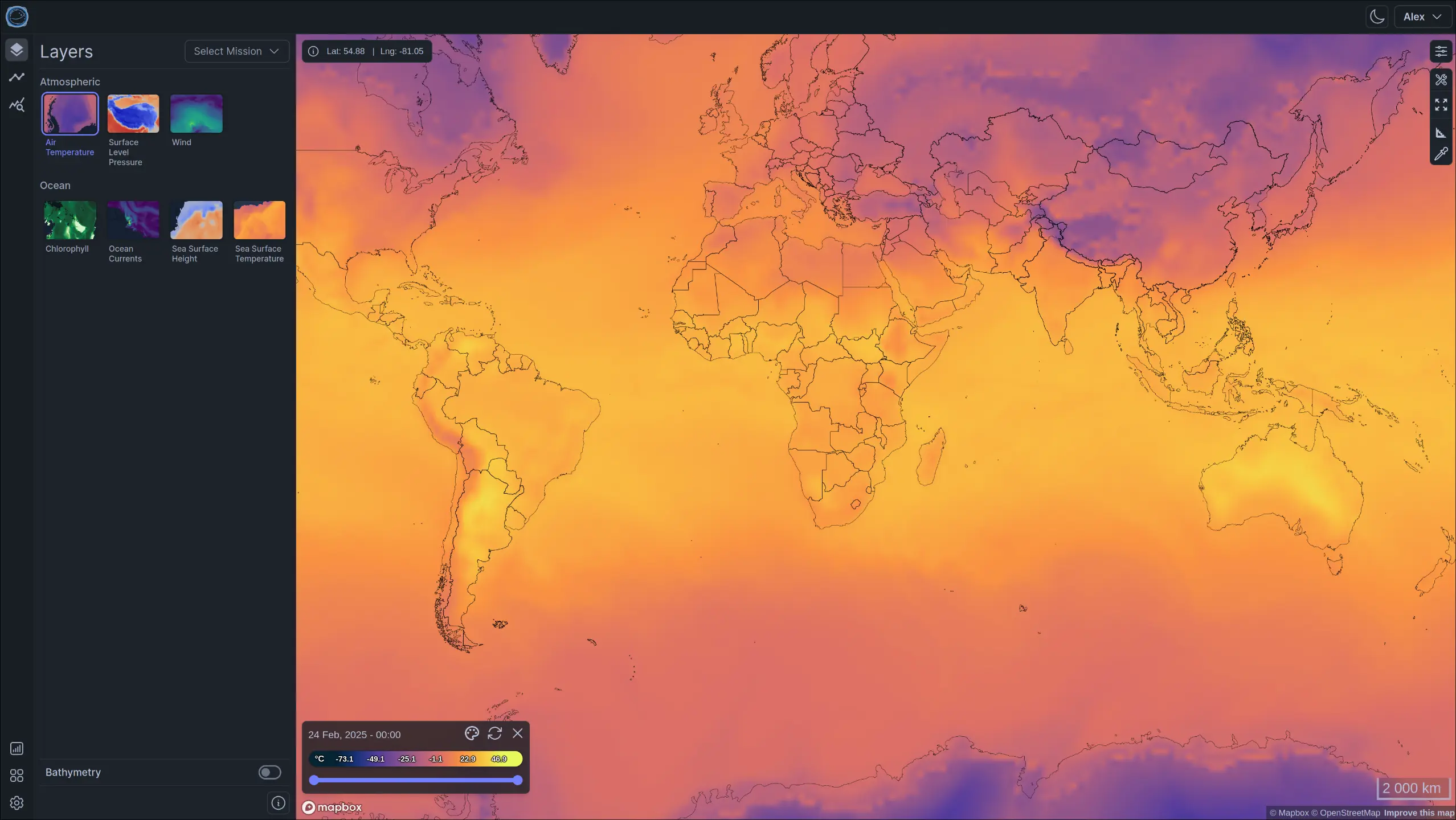
High level Overview of Vehicles and Data
Start with a high level overview of your fleet with a reactive and realtime map. Toggle the visibility of geospatial layers and overlays, find your vehicles and see their data.
- Realtime Updates
- Multiple Geospatial Overlays
- Historical Data View
- Customizable
- Integration of multiple in situe datasets possible (Argo Floats, Spotter Buoys)
- Intuitive and User Friendly
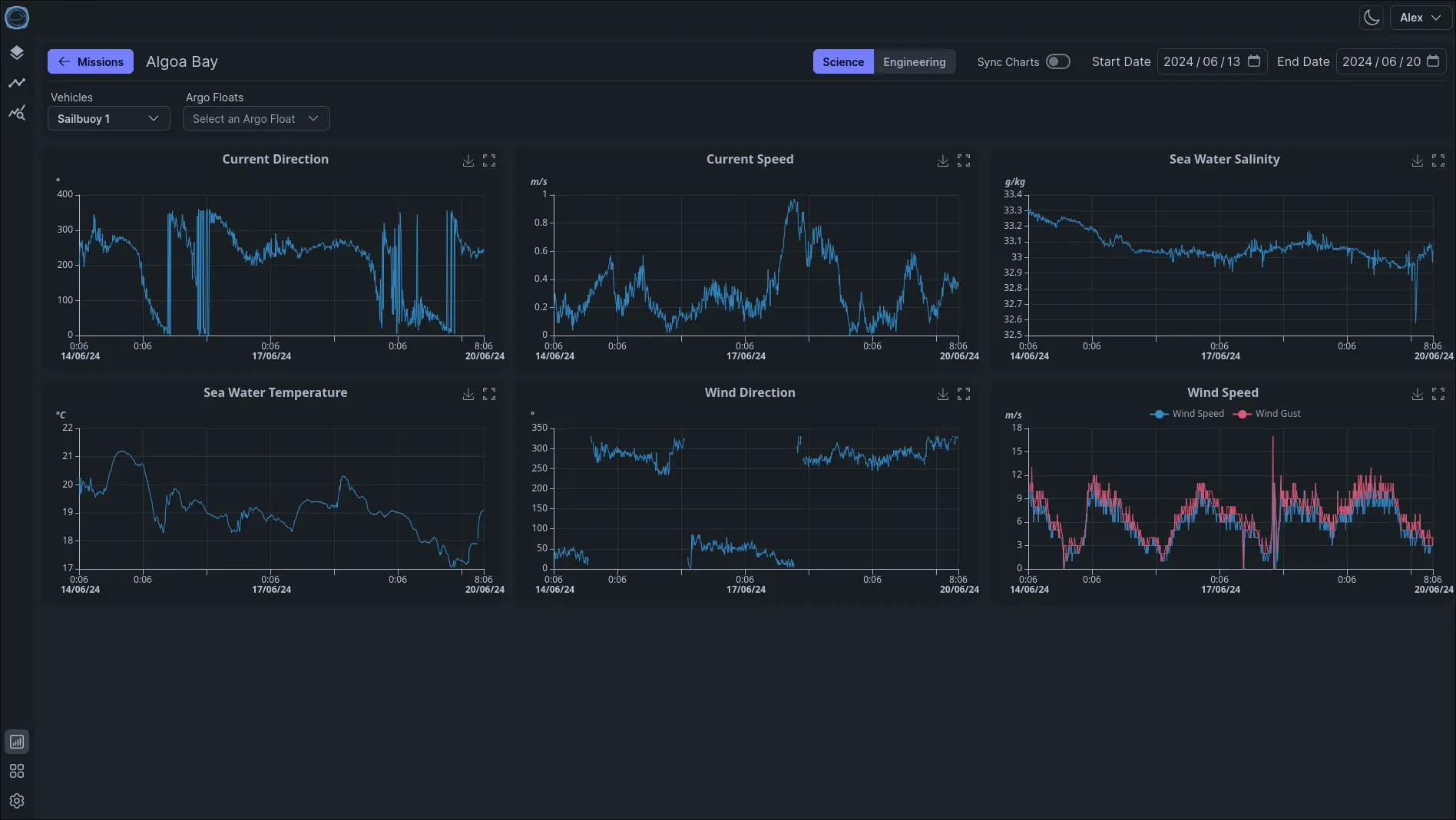
Analyse Vehicle Data
Build your own charts dashboard to see the data that's valuable to you and your team.
- Customizable Charts
- Interactive
- Categorize Charts
- Mobile Optimized
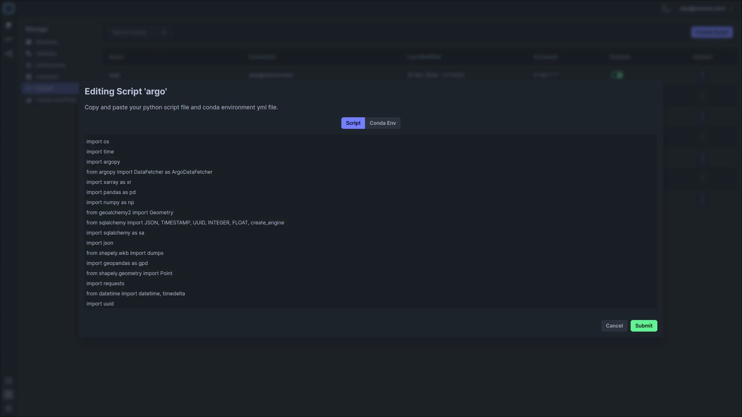
Custom Scripts
Write custom scripts to fetch data for your vehicles
- Supports python and conda
- Use scripts to fetch and preprocess data
- Configure when scripts run using cron schedules
Use Cases
The OceanLens platform provides a variety of usecases
Academic Research
Ocean scientist or researcher in Acedemia? Remove the headache of building your own dashboard and tooling for your deployments. OceanLens was designed with academic researchers in mind.
Marine Industry
Do you service or monitor offshore wind and oil projects using robotics? Optimize your missions using our secure services.
Multi Manufacturer Deployments
OceanLens supports the integration of multiple platforms from different manufacturers. It already supports: Seagliders(Applied Physics Laboratory), SeaExplorer (Alseamar), Waveglider (Liquid Robotics) and Sailbuoy (Offshore Sensing).